Brian is the President of Neoweather and has been one of the leaders of the organization since joining in 2011. He loves helping Neoweather grow with excellent customer service and positive impacts to the operations of all clients. Brian graduated with degrees in broadcast journalism and meteorology. Brian worked as a meteorologist in Youngstown, Steubenville and beyond. He loves Cleveland sports and enjoys going to games. You can also find him trying new spots to eat, traveling and being active outside.
Get ready, New England! Mother Nature is about to put on a snowy show! ❄️🌟before a celestial one.Several inches of snow predicted to blanket the region. The Great American Total Solar Eclipse is also on the horizon. 🌑🌞 This celestial spectacle, where the moon cloaks the sun and day turns into night, is a sight…
Get the inside scoop on upcoming weather patterns. From sunny spells to stormy surprises, we’ve got you covered. Plan on a few rain systems across the East. There could be a stripe of Midwest snow. The big deal is the up and down temp swings. Want Info For Snow Contractors? Want to see snowfall records…
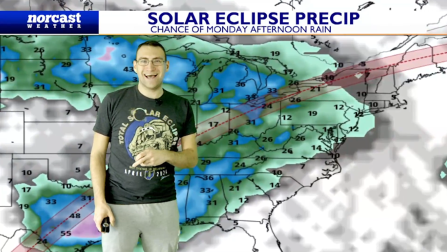
Areas of the Upper Midwest that saw a record warm winter will now get into A foot of snow and cold. We go over the next few big systems producing severe storms and heavy snow on the northern side. We also talk about weather impacts during the solar eclipse. Want Info For Snow Contractors? Want…
One of the more significant winter storms of the season hits Denver and surrounding areas. We are talking about over a foot of snow likely with over two FEET in the Rockies. While this system is ongoing a severe weather event hits the middle states and then some snow around St. Patrick’s Day for the…
It’s still going to be much above average in the temperature department. Let’s examine drought risks and where snow is possible this weekend after severe storms. Want Info For Snow Contractors? Want to see snowfall records in your city? https://blog.snowplownews.com/snowfall_records/ To get the latest snow and ice control industry news check out Snow Plow News https://blog.snowplownews.com/ If…
From severe storms and a crazy extreme cold front to more spring weather. March is sure coming in a little intense in spots with Sierra Nevada’s seeing feet of snow and a very active stretch likely for the East. It will generally be very warm, but mid March should have a few colder days. Let’s…
Wellll the cold pattern is not happening, but the active pattern sure is. Spots will see a few inches of rain in the next week. The big story is there is severe weather chances two different times. Want Info For Snow Contractors? Want to see snowfall records in your city? https://blog.snowplownews.com/snowfall_records/ To get the latest snow…
Are you looking forward to the cold and snow across the East? Oh wait… Well it’s a bit muted from what we thought with rounds of cold and snow. We get back to a more average pattern, but any below average cold, just won’t last long. If you want to feel like spring head to…
The pattern changes back to winter in spots that are very warm! Let’s touch on a few things: – California Heavy Rain – Jet Stream Pattern – Big Snow Possible Early Week? – Cold Air Sticks Later Month Want Info For Snow Contractors? Want to see snowfall records in your city? https://blog.snowplownews.com/snowfall_records/ To get the latest…
We are still on track for the next couple weeks to be generally mild outside of the West. West Coast into Rocky Mountains deal with some cold and snow with plenty of rain into the lower terrain. Elsewhere it’s about an extended mild stretch. The well above average temperatures are because it’s sustained mild not…


