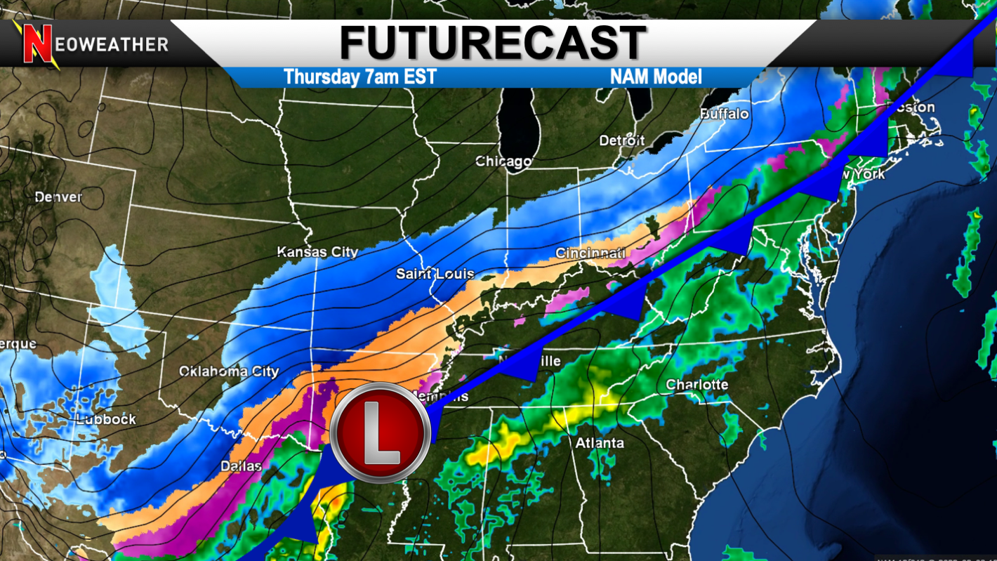
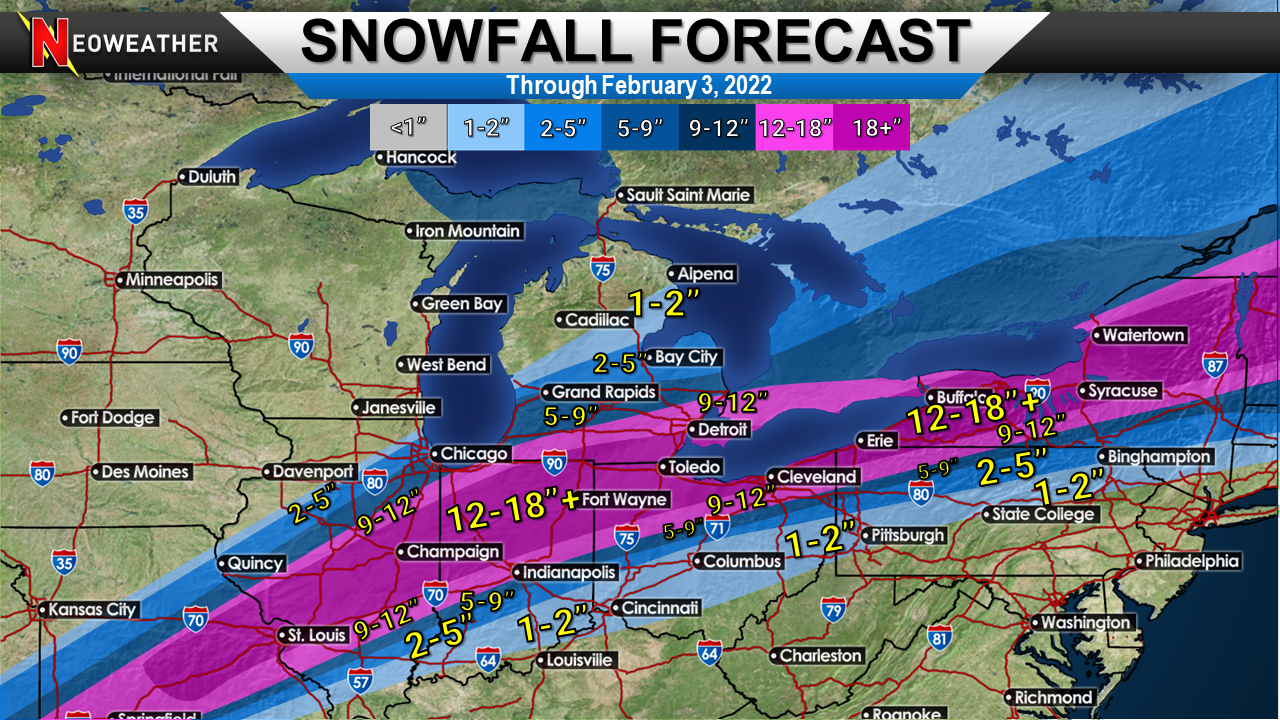
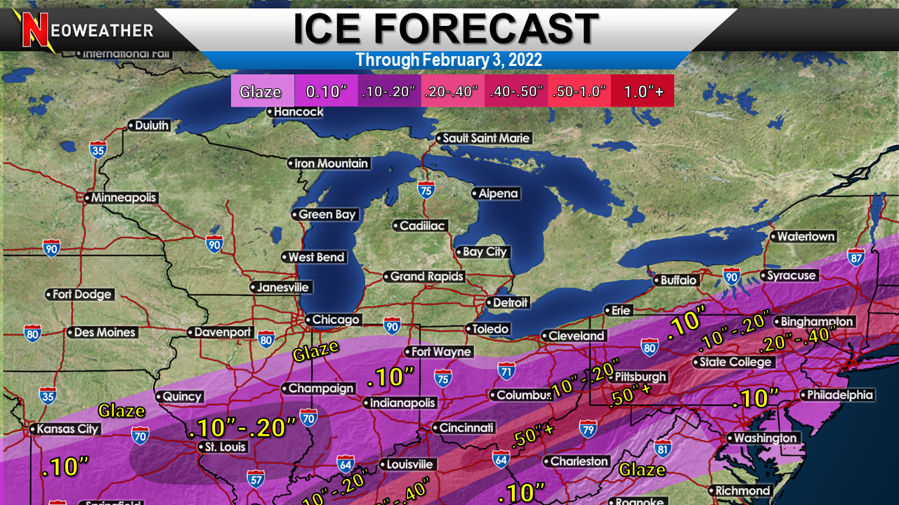
Just days after the Nor’Easter broke some snowfall records another well above average winter storm is going to plow across a large section of the eastern half of the country. This storm is notable because of how big and long-lasting it is. Multiple waves of moisture will create a corridor of 1-2 feet of snow with decent icing just to the south.

The video below breaks down the timing and snow/ice amounts expected. While blizzard conditions won’t be common there will be gusty winds causing some potent blowing and drifting. There could be another system this weekend for the East Coast. Lots of cold is likely across the South and East before we see some mid month thaws.
How much snow and ice do we likely see? This is going to be subject to change, but presents the general idea.


Want Info For Snow Contractors?
Want to see snowfall records in your city? https://blog.snowplownews.com/snowfall_records/
To get the latest snow and ice control industry news check out Snow Plow News https://blog.snowplownews.com/
If you are looking for expert weather forecasting and meteorological support then Neoweather can greatly help with information specific for the snow and ice management industry. https://neoweather.us/services/snow-ice/


