Seasonal forecasting is not a guess, but it’s vastly different than forecasting a few days out. We are happy to provide a winter forecast for the 10th year now. Our outlook will dive into some of the main pattern drivers. Get ready to learn a little long range meteorology and have some fun.
Below is our full TV-style winter forecast presentation. Not only do we tell you which areas are favored to have lots of cold and snow, but find out the recent changes to the National Weather Service winter weather headlines. Plus there’s weather trivia that you can test your knowledge.
At A Glance
- Generally Mild Conditions For A Majority Of The Country
- La Nina Conditions
- There Will Be Potent Cold Blasts & Big Snows
October ended and November started cold across the eastern half of the nation with warmth west. Big changes are happening, which sets up the opposite temperature regime. Cold and snow becomes common into mid November in the West.
There are cold chances late November and in December across the East and some of that could be potent. An active jet stream pattern should bring increased chances of low pressure systems developing. There might be more snows in the early season compared to recent years.
The Main Setup

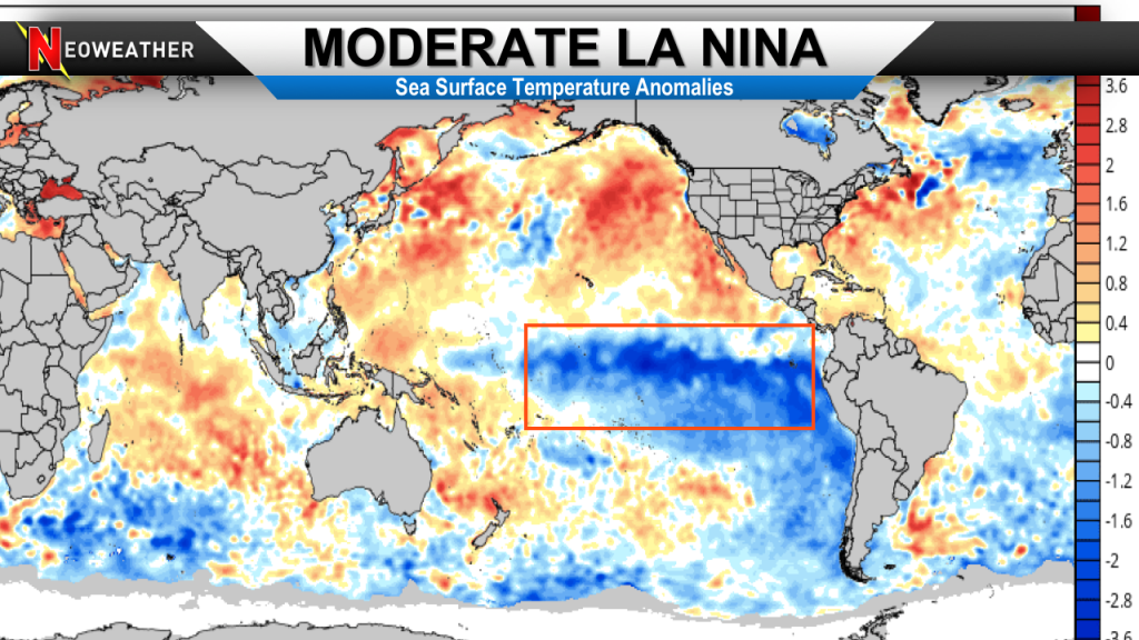
The blue color you see in the Pacific Ocean is a moderate La Nina. This means below average water temperatures. It’s a large area of cool water stretching across the central portion of the Ocean. The La Nina is still strengthening and could become strong. If this happens this will be a very overwhelming factor on the overall winter pattern. The El Nino Southern Oscillation if it’s weak or neutral has much less of an overall impact.
The Jet Stream
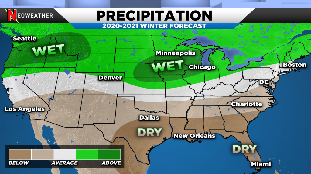
Many of the other climate weather drivers have impacts also. These pressure and temperatures regimes in different parts of the world influence where the jet stream sets up. The position of the jet stream gives us strong clues into where ridges and troughs exist. We believe a good amount of warm air flows into the United States and active patterns become common. Expect a good dose of precipitation across the North.

This is a fairly typical La Nina pattern. Our winter forecast and subsequent video was made between early September and mid October. As we get into November our concern for an even stronger La Nina might point to more extremes with drought, flooding and well above average temperatures.
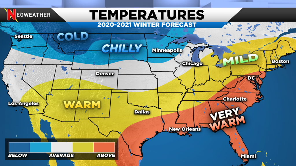
As of early November there is still some confidence on areas of cold that could dominate in western Canada into the Northwest US. These Arctic outbreaks can swing eastward into the Midwest and Great Lakes at times. If this happens there would be enough chances at snow to bring the Midwest into the Great Lakes above average.

What if the cold stays locked up in Canada? It’s very possible with a strong La Nina that the Polar Vortex stays strong and there’s limited disruption to shove the major winter chill south into much of the US. Typically with stronger La Nina’s the North Atlantic Oscillation (NAO) stays in the positive phase, which favors a warmer central and eastern US. This winter could be very warm (again!) for a large section of the nation.
If your operation depends on an accurate weather forecast, so you can make big money decisions then you are on the right website. It’s our life providing you with peace of mind through detailed weather information. Our snow and ice management forecast service is where you should check out. There are many reasons why it’s Time To Purchase a Weather Service. Your company deserves better than inconsistent free apps, amateur weather sites and TV news then let’s talk. Savvy snow contractors depend on our service. If you are interested then get a free quote today.


